Secret Maps at the British Library: A Journey Through Power, Art and History
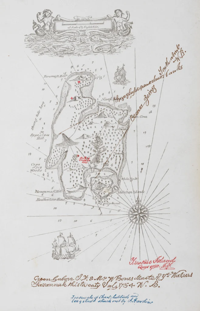
To stand in front of the ink-drawn map of Treasure Island recreated from Robert Louis Stevenson’s own hand, or stare into the Aztec black obsidian stone polished mirror, brought back by Elizabeth I’s advisor John Dee, for soothsayers to see the future, is to dissolve into the magic, meaning and romance of Secret Maps. No dry, dog-eared atlases here. The wonder curated by the British Library in King’s Cross can genuinely blow your mind if you are prepared to let it.
Maps are shown as powerful, political and sometimes deadly human artefacts, not only beautiful and beguiling but signposts to the future. The show is fantastic at reminding you that maps are never just maps.
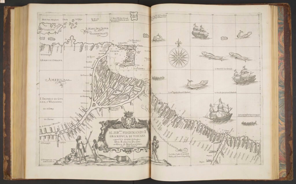
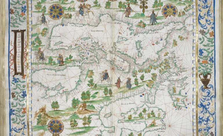
From colonial sea charts complete with sea monsters and mermaids, to secret boundary plans from Lord Mountbatten for the partition of India, to real covert, Boys’ Own wartime escape maps hidden in Red Cross board games sent to airforce prisoners in Colditz, or in one wonderful case woven into ladies’ lingerie.
Arts & Culture — More from EyeOnLondon
Discover more exhibitions, features and reviews to keep exploring London’s cultural life.
City Lights, Longer Nights: EyeOnLondon Edition 28
A curated edition of arts, theatre and city stories, from late-night openings to seasonal highlights across London.
Read the featureMore Arts & Culture
MoMA’s 2026 Duchamp Retrospective
Looking ahead to MoMA’s major Duchamp show, from The Large Glass to Étant donnés and the legacy of conceptual art.
Read the articleMore Arts & Culture
Building the Bank: Bank of England Museum Exhibition
An inside look at how the Bank of England’s architecture was shaped by power, security and the changing City skyline.
Read the reviewMore Arts & Culture
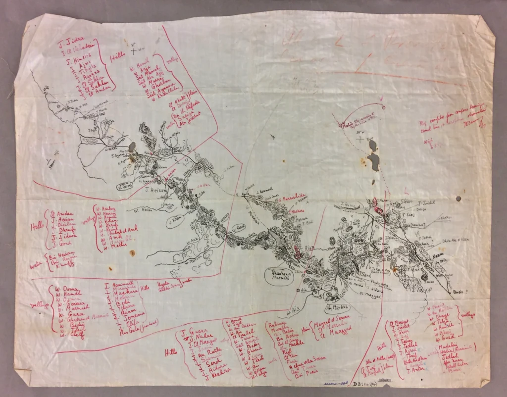
Gaze upon Lawrence of Arabia’s silk map, carried across the desert towards Damascus, its fragile surface bearing the traces of a life lived in the field. It is one of many objects that make you step closer, looking for the stories left behind by the hands that used them.
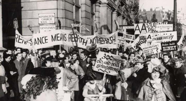
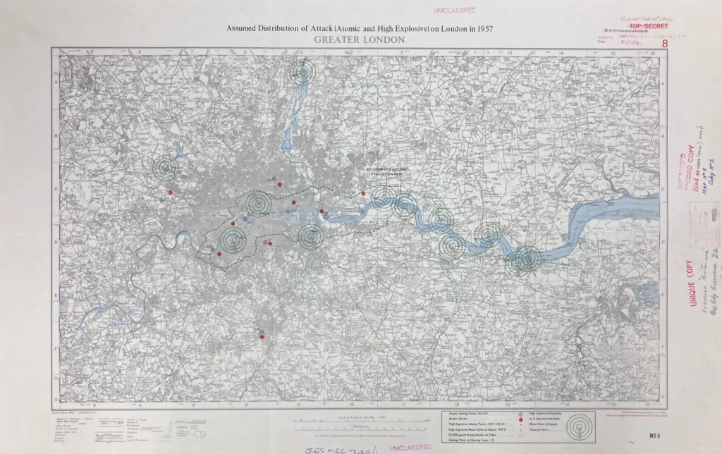
Modern-day surveillance maps showing Catholic and Protestant houses in Troubles-era Belfast are juxtaposed against a mid-1970s LGBTQ+ Gay To Z London directory map. The exhibition demonstrates how cartography can, and has been, used to control land, people and even history. It contains some of the most emotive and thought-provoking artefacts in human history.
One chilling exhibit presents side-by-side maps from the apartheid era, where entire Black townships were simply erased from official South African mapping. Later maps restore them, the contrast speaking volumes.
The historical breadth is wide and rich. There are maps from the fourteenth century through to present-day digital and satellite mapping. Stories abound: a map drawn from memory by a Māori chief in 1793; First World War trench maps; escape maps folded into hairbrushes for prisoners of war; and modern maps tracing refugee journeys across continents.
The exhibition does more than show old maps. It reflects on power, secrecy, identity, oppression and resistance. It explores how maps have been used for imperial conquest, but also how people and communities are formed, designed and even destroyed.
This political message is to the fore in the video installations that permeate these wonders at regular intervals, pumping out on a loop the modern mantra of diversity and inclusion and the single story of maps as colonialism and oppression that is shaming. If you can accept this as part and parcel of modern life today and file it away, then Secret Maps at the British Library will truly blow your mind.
Follow EyeOnLondon for more cultural features, exhibitions and London stories that encourage deeper thinking and discovery.
Secret Maps
The British Library, King’s Cross | Now open
A powerful exhibition revealing how maps shape power, identity and history, from ancient cartography to modern politics and digital mapping.
Visit the British Library for exhibition details and ticket information
For more London exhibitions and cultural features, visit our Arts & Culture section.
Follow us on:
Subscribe to our YouTube channel for the latest videos and updates!
We value your thoughts! Share your feedback and help us make EyeOnLondon even better!